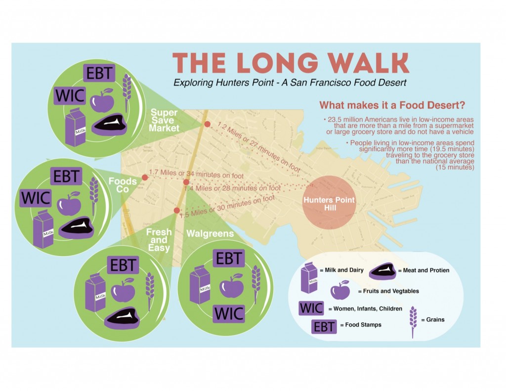
The Long Walk: Mapping Hunters Point, a food desert
I know its been a while since I announced The Long Walk, an original Performance/Data collection piece I created about San Francisco's Food Desert, Hunters Point. However, I wanted to share with you, the finished product of that process. In case you missed that incarnation, here is a little background on the issue I blogged about earlier:
'Unequal access to healthy food based on income and specifically within low-income neighborhoods is a huge problem in America. 2.3 million Americans live over a mile away from a grocery store without access to a vehicle. This has created something known as a “Food Desert†where entire low-income neighborhoods are under-served in access to the basic human right of healthy, unprocessed food. People living in low-income areas spend significantly more time (19.5 minutes) traveling to the grocery store than the national average (15 minutes) according to the USDA. The USDA has also created this Food Desert Locator, albeit somewhat inaccurate as it does not take into account corner stores with fresh fruit and vegetables, it is still a step in the right direction.'
Hunter's Point is listed on the USDA Food Desert Locator and was named one of the "Top 9 Worst US Urban Food Deserts." What I did to examine this issue, is create a visual map and an interactive Google Map that focuses on the Food Desert we have within our city boarders, in Hunter's Point. The Map I created lists the closest shopping options for the residents of Hunters point, including a key that details the types of food sold and weather or not they support Food Stamps (EBT) and Women Infants and Children (WIC ) coupons for low income mothers. The map also tracks the distance amount of time it takes on foot to travel one-way to the store from the center of Hunter's Point Hill. Check out the visual map below and the interactive map here.
